Geospatial Engineering
By Daniel Visone, Col. James “JD” Scott, USA, and Scott Ensign, M.SAME
With an increasing need for commanders to have an understanding of infrastructure and the physical environment both on and off the battlefield, geospatial engineers must be able to provide a global, holistic, and cohesive view through tools like the Joint Engineer Common Operating Picture.
From ancient warfare to modern armed conflict, the principle of mastering terrain is timeless and foundational to success. Commanders must understand where friendly forces and enemy troops can maneuver and defend, and where to exploit the physical environment to gain positional advantage.
Every joint geospatial engineer, and the units they support, can start using JECOP now. This would be a quick win, to bring all the services into a single geographic information system to better share, analyze, and display geospatial data.
While topographical mastery remains just as important today as it was in the age of ancient warfare, this need has expanded beyond traditional battlefields to also include the homeland. In 2013, Gen. Martin Dempsey, USA, then-Chairman of the Joint Chiefs of Staff, stated: “Our homeland is not the sanctuary it once was.” In 2018, the National Defense Strategy proclaimed “it is undeniable that the homeland is no longer a sanctuary.”
To better understand our modern terrain, which encompasses facilities, infrastructure, and the physical topographical environment, joint geospatial engineers must not only master their skills at providing data but also integrating it across current silos to generate a truly holistic picture that is actionable.
Providing Understanding
Imagine a future scenario where adversaries initiate armed conflict with the United States and its allies in a coordinated cyber, informational, and physical attack on several military installations domestically and overseas, and to include both U.S. and partner nation locations. The attack reduces joint and multi-national force projection and military capabilities. Installations, however, are able to quickly assess damage and begin repairs. Senior military leaders accurately assess the attack’s effects on units, bases, and overall abilities to deploy and employ the Joint Force, and provide response options to U.S. political leaders. Within weeks, resources are funneled to the right locations to restore full capabilities, and civilian and military leaders understand capability as it returns and improves options. The speed of the U.S. response overwhelms the adversaries and de-escalates the conflict, resulting in a negotiated end that places the United States and its partners in a more advantageous geopolitical position.
While acquiring and maintaining these highly technical skills is critical for a joint geospatial engineer, equally important is being able to bring them to bear.
At the center of the positive outcome in this scenario is geospatial engineering: the ability to see, understand, visualize, and describe the terrain and physical sites as leaders assess threat effects on military operations. From fort to port, from airfield to landing strip, from installation to objective, there is an interconnected system of systems that must be seen and understood.
The responsibility to provide this understanding rests on the shoulders of joint geospatial engineers and is more demanding and complex in Joint All-Domain Operations than ever before. Joint geospatial engineers are comprised of 13 uniformed and civil service career fields. Their capabilities are integrated by the Joint Staff J45 for facilities and infrastructure and Joint Staff J28 for operations. Together, they provide the Joint Force with a global, holistic, and cohesive view of infrastructure and the terrain. This digital mastery of infrastructure and terrain is foundational to understand both friendly and threat forces, to enable Joint All Domain Command and Control, and to synchronize Joint Forces across the competition continuum.
Broad Range of Skills
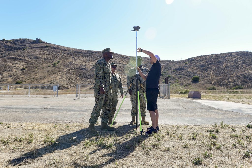
The geospatial engineering function, as defined by Joint Publication 3-34, Joint Engineer Operations, encompasses survey and mapping, remote sensing, geospatial information systems, computer-aided drafting and design, building information modeling, and other engineer tasks employing geospatial engineering capabilities. These require units to generate, collect, integrate, analyze, and visualize location-enabled data for engineers and the joint understanding of complex operating environments.
Overall, joint geospatial engineer skillsets include a broad range of responsibilities, which continue to evolve alongside technology.
Computer-aided drafting and design/building information modeling/3D.
- Geospatial information system development and sustainment.
- Geospatial data, product generation, and analysis.
- Geospatial database development and management.
- Geospatial data standards development, such as the Ground-Warfighter Geospatial Data Model and Spatial Data Standard for Facilities, Infrastructure, and Environment.
- Surveying.
- Remote sensing (such as imagery, light detection and ranging, or thermal data collection, processing, and analysis).
- Manned aircraft and satellite, terrestrial, and small unmanned aerial systems.
While acquiring and maintaining these highly technical skills is critical for a joint geospatial engineer, equally important is being able to bring them to bear. Presently, the only tool that integrates the infrastructure and operational focus of geospatial data is the Joint Engineer Common Operating Picture (JECOP). Hosted and funded by the U.S. Army Corps of Engineers out of its Reachback Engineer Data Integration based in Vicksburg, Miss., the JECOP is where infrastructure and operational geospatial engineering meet.

Both installation and infrastructure data is managed by defense installations, while facilities data is overseen by the U.S. Army Corps of Engineers. Operational geospatial data is managed by the combatant commands, and is mostly generated by the National Geospatial-Intelligence Agency and Army Geospatial Center, which produce and disseminate imagery, feature data, digital maps and charts, elevation data, and 3D data to support operations. The Joint Force refers to this type of data as Foundation GEOINT, while the Army calls it Standard Shareable Geospatial Foundation.
Using this expansive data to its maximum potential requires integration. JECOP is a great start to give geospatial engineers a collaborative space to manage, analyze, and display global geospatial data like installations, lines of communication, and terrain enabling mission command and visualization of the operational
environment. These capabilities are the keys for success in decision dominance, rapid decision, and taking action to outthink adversaries.
Using this expansive data to its maximum potential requires integration. JECOP is a great start to give geospatial engineers a collaborative space to manage, analyze, and display global geospatial data like installations, lines of communication, and terrain enabling mission command and visualization of the operational environment.
Increasing Integration
Every joint geospatial engineer, and the units they support, can start using JECOP now. This would be a quick win, to bring all the services into a single geographic information system to better share, analyze, and display geospatial data.
Another swift and practical solution to better integrate infrastructure, facility, and operational geospatial engineering would be standardizing location data with all military construction around the world, using a military grid reference system for the location field in the DD Form 1391. Currently, it is free text. Compiling data on all military projects and facilities globally is a major challenge. Standardized location will enable far more accurate and complete common operating pictures—from installation and facility management to combatant commands understanding power projection capabilities and vulnerabilities.
Even these steps are not the end. Rather, they represent the beginning of a journey to develop a more holistic view of our modern military landscape. We need more integration between our silos of data and the various tools available both for today, and tomorrow.
Daniel Visone is Acting Director, Army Geospatial Center; daniel.l.visone@usace.army.mil.
Col. James “JD” Scott, USA, is Geospatial Analyst, Army TRADOC Proponent Office – Geospatial; james.d.scott14.mil@army.mil.
Scott Ensign, M.SAME, is Air Force GeoBase Program Manager and Geospatial Integration Officer, AFCEC Geospatial Engineering Office; swensign.same@outlook.com.
Article published in The Military Engineer, September-October 2024
More News from TME
-

Meeting Data-Intensive Challenges With Narrow AI
When considering solutions for targeted, data-intensive problems, such as a recent challenge undertaken by the Air Force Civil Engineer Center to predict construction project priorities, the use of traditional narrow artificial intelligence still beats emerging technologies. -
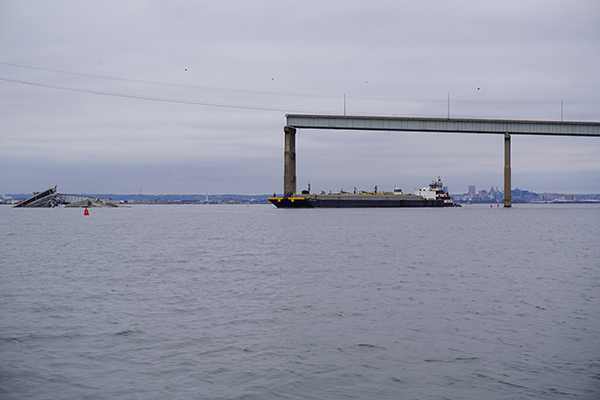
Leveraging Geospatial Data Tools on the Key Bridge Response
In carrying out the joint response after the Key Bridge collapse, the U.S. Coast Guard and other partner agencies leveraged both internal and external geographic information system expertise to provide data-sharing and near real-time monitoring capabilities. -

A Hydrogen Fuel Cell Vehicle for Austere Environments
An innovative fuel cell emergency vehicle developed by the U.S. Army Engineer Research & Development Center can provide exportable power, water, and a climate-controlled command center on a zero-emission platform to aid in humanitarian assistance and disaster relief efforts where sites lack utilities and infrastructure.