
Industry-government engagement took a unique form during the 2023 JETC, with a total of 14 government and industry organizations joining together for GeoWERX III. The highly collaborative demonstration showcased the power of location-enabled data, processes, and tools—serving to expand the awareness of engineer resources that enable data as a weapons system supporting contingency operations, facility asset management, health engineering, and resiliency.
Real-World Scenario
To help drive this year’s GeoWERX, the team used the scenario of a hurricane striking a Central American nation, leading to an international humanitarian assistance response. Participants conducted infrastructure impact, international transportation, and displaced persons beddown analysis of both the impacted country and south-central Texas.
As part of the scenario, the convention center was identified as a facility that would support the relocation of displaced personnel from the storm. Data from around the convention center and within the building was collected through open-source, remote-sensing, high-definition survey; by bioenvironmental engineering sensors; and from other geospatial-enabled tools. Collected data provided a rich treasure trove and enabled the development of detailed analysis and products supporting planning and execution decisions.
Location Data as a Weapon System
For millennia, military engineers have mastered terrain. Today, geospatial engineers continue the tradition as digital warriors who create the understanding of complex and ever-evolving operating environments. However, this understanding is often compartmentalized within each service, their installations, and within combatant command areas of responsibility.
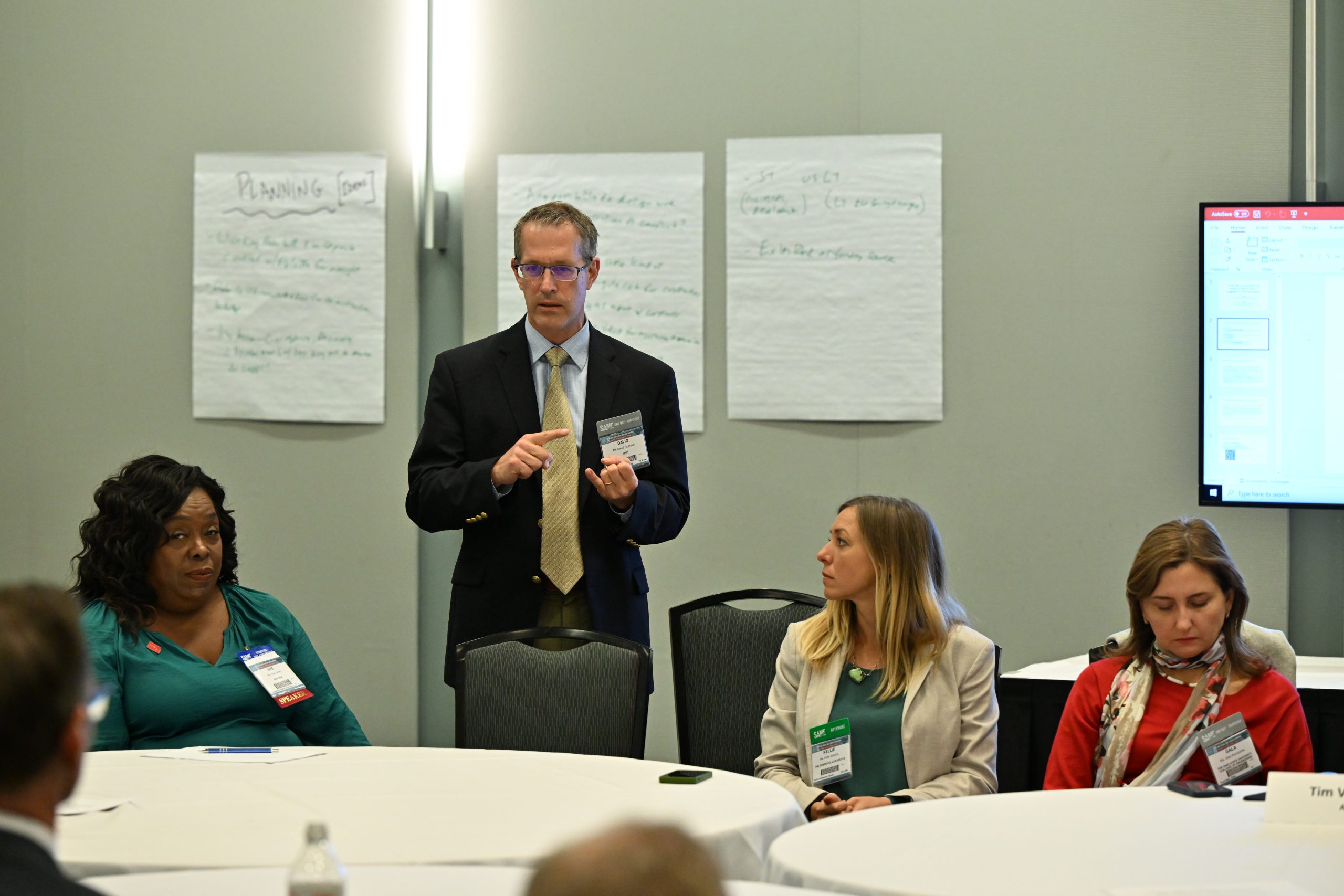
The Joint Force is making strides to overcome this challenge with All Domain Command and Control. This includes joint engineers working to create a global geospatial data foundation comprised of installations, lines of communication, and terrain-enabling mission command and visualization of the operational environment. These efforts also provide the intelligence community with an accurate geospatial foundation for conducting comprehensive analysis of threats and their effects globally. Another step in expanding the awareness and leveraging of geospatial engineering was taken during the 2023 JETC with the inaugural Joint Geospatial Engineering Seminar. Senior leaders from the U.S. government and industry held three sessions to improve how to treat location data as a weapon system for warfighting, contingency, and installation requirements. From all accounts, the insights provided were a great step in the right direction to address geospatial engineering challenges.
Hands-On Engagement
GeoWERX III provided an interactive event where attendees could engage with geospatial engineering experts in their operating environment and observe some of the techniques and resources they employ to make the invisible visible and support installation, contingency, and warfighting requirements.
Visitors saw firsthand the speed that data, products, and awareness was achieved. They asked specific questions on how to tap into the demonstrated capabilities readily available for their mission.
Open-Source Data. Data from various sources was easily discovered online. This enabled the ability to describe the operating environments in both the impacted Central American country and south-central Texas. Among the geospatial-enabled data gathered included LiDAR, medical, population, orthorectified imagery, pre-planned displaced personnel support locations, transportation, and weather.
Bioenvironmental Engineering Sensors. Water and air quality within and around the convention center was continuously monitored. Tabular bioenvironmental data collected to ensure force protection was geo-enabled manually at the start, then supported by a mobile application to speed collection and reduce chances of errors in transcription.
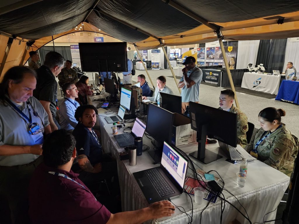
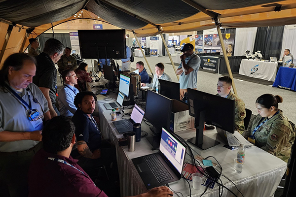
Deployable Geospatial Workstation and Ammo Can Server. The Deployable Geospatial Workstation and Ammo Can functioned as the compact central hub and processing engine for data collected by the GeoWERX team members.
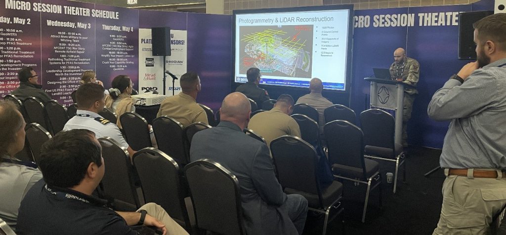
High-Definition Survey. LiDAR applications exponentially improved the ability to rapidly collect built and natural infrastructure “digital twin” data. LiDAR was extensively used to document the interior and exterior of the convention center, expediting data collection and displaced personnel beddown and life support planning.
Machine Learning. Challenges of large and complex data sets related to the affected country’s weather, population, and transportation were significantly reduced by a data model leveraging machine learning.
Mobile Data Collection Application. Bioenvironmental engineer data collection processes were enhanced with the introduction of a geo-enabled mobile phone application. Unique forms were created based on specific data targeted for collection and the process by which it would be accomplished.
Survey Control. Establishment of survey control in and around the convention center facilitated accurate integration of data collected by various means and methods.
Small Unmanned Aerial Systems. During the demonstration, unmanned aerial systems collected imagery and LiDAR of the convention center and surrounding infrastructure, then integrated it with existing data. This provided rapid and common context in addition to enabling change detection. Moreover, this was very useful in detecting major modifications to the built and natural infrastructure created by construction happening within the vicinity.
Standard Designs. Standard designs for camps to house displaced persons provided accurate planning factors applied to the locations within the affected country and south-central Texas. Data from the standard design was integrated with collected geospatial data. This improved accounting for how the local terrain would impact construction activities.
3D Modeling. Comprehensive understanding of built and natural infrastructure in and around the convention center was bolstered by 3D models that were created by meshing diverse data sets. This data provided the digital foundation for construction planning and asset management over the lifecycle of the mission.
Story Map. Unclassified shared situational awareness of GeoWERX activities was made possible through Story Map. This easy-to-use tool can support all engineering missions to improve context and increase the understanding of stakeholders more effectively.
Leadership Input
Acting as notional commanders for the scenario were Col. Kevin Golinghorst, USA, and Col. Chad Ramskugler, USA, who received multiple update briefings throughout the week, adding to the effectiveness of the training scenario. Chief Master Sgt. Robert Cullison, USAF and Lt. Col. Rueben Choi, USAF, also had leadership roles.
Briefings were conducted primarily by non-commissioned officers, who received invaluable feedback through the exercise.
Lt. Col. David Foster, M.SAME, USA (Ret.), 372 Consulting LLC, is Chair, SAME Geospatial Working Group; david.foster@372consulting.com.
Innovation Via Integration

GeoWERX III supported the mission of SAME’s Geospatial Working Group to expand awareness and leverage geospatial engineering for operational effects by exposing visitors to existing resources and processes available. Future demonstrations will continue to reveal the integration of modern geo-enabled engineering applications at the speed that technologies evolve. Federal organizations participating included the 512th Geospatial Planning Cell, 802nd Civil Engineer Squadron, Army Geospatial Center, Air Force GeoBase Program, Defense Health Agency, Joint Base San Antonio, and Oak Ridge National Laboratory.
Spotlight on Our Society
In Focus digs deep into singular programs and events from across the Society, shining a light on how SAME is making an impact on developing multidisciplined solutions to national security infrastructure challenges.
-
In Focus: Exploring Asset Management Challenges
SAME’s Facility Asset Management COI serves to enhance the efficient, effective, and sustainable stewardship of federal facilities, providing a collaborative platform for sharing resources, technologies, and strategies that support informed decision-making and risk management through the FAM Forum at JETC. -
In Focus: Managing Assets At JETC
At the 2023 JETC, geospatial engineers continue the tradition as digital warriors who create the understanding of complex and ever-evolving operating environments. -
In Focus: Preparing for Ukraine Reconstruction
The SAME JECO Community of Interest has been preparing for the eventuality of reconstruction efforts in Ukraine through tabletop exercises, panel discussions, and more.