By Ashish Shrestha, Ph.D., and Christopher Chini, Ph.D.
At Tyndall AFB, an installation that is highly vulnerable to extreme weather, researchers piloted a unique approach that leverages high-resolution hydrologic-hydraulic models to illuminate resilience concerns affecting drainage systems during compounding climate events.
Coastal infrastructure systems are increasingly at risk from climate change-induced recurrent flooding, driven by the frequent occurrence of high-intensity short-duration rainfall and high tide events from storm surge and sea level rise.
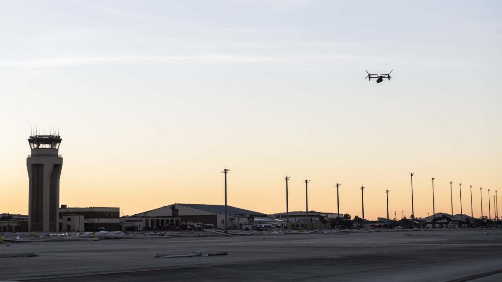
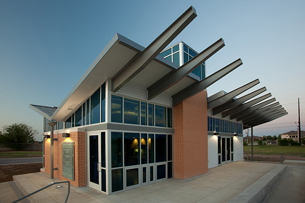
Airfields are critical infrastructure utilized every day in carrying out Department of Defense operations. Those runways supporting installations in coastal areas are especially valuable given their proximity to the nation’s borders and as access points for mission origin. Building resilient coastal stormwater systems to support military airfields and their operations is paramount.
As climate change continues to drive more intense storm events, compound effects from extreme rainfall and high tides can overwhelm the storage and transport capacity of stormwater systems. High tides at the outfall of the drainage network can cause backwater effects due to reduced hydraulic head, which impedes efficient runoff removal. It is essential to assess the hydrologic and hydraulic responses of an airfield’s drainage system and evaluate its criticality and fragility.
The fragility curves illuminate which area is more sensitive to high tides and extreme rainfall. Should the probability of failure be deemed unacceptable, adaptation efforts can be targeted.
Airfield systems in coastal environments are notably susceptible to recurrent flooding events. The Air Force Institute of Technology recently completed an effort to develop high-resolution hydrologic-hydraulic models of Tyndall AFB, Fla., to analyze its hydrologic risk for stormwater infrastructure decision making. As part of this study, the team developed a risk-based framework, utilizing a deterministic model to generate fragility curves for airfield flooding under different intensity of combined hazards from extreme precipitation and high tides. Results from the project will aid in informing adaptation efforts and resilience concerns.
Gathering Data
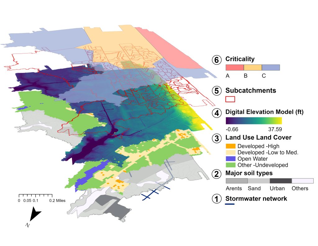
Tyndall AFB sits adjacent to the Gulf of Mexico with an average elevation of 11.68-ft. The base is susceptible to pluvial flooding and coastal flooding. The rainfall-generated runoff from Tyndall’s airfield flows through a network of stormwater conduits with outfalls at Fred Bayou and Little Cedar Bayou connected to East Bay.
Flooding across the airfield can affect several of the installation’s functions through inundation at its runways and buildings. It is important to understand the nature of the risk posed to the stormwater system and how those risks are distributed across the installation. Accurately estimating flood volume and assessing flood impacts requires high-resolution temporal and spatial data, including rainfall (forcing data) and runoff (response data).
To develop these high-resolution models, the research team with the Air Force Institute of Technology installed multi-sensor autonomous wireless monitoring devices to collect 1-min resolution measurements through a Supervisory Control and Data Acquisition Platform. The instrument included a factory calibrated 8-in diameter self-emptying/tipping bucket rain gauge tested for 0.01-in increment measurements that meets National Weather Service specifications installed within the Tyndall watershed. Additionally, it captures dual-wave ultrasonic Doppler Area-Velocity sensors flow meters installed at two locations on the downstream end of the stormwater conduit near the intersection of ground surface and sea-level to measure positive (as normal runoff) and negative velocities (as backwater flow).
Building the Model
In building the model, the researchers utilized the Environmental Protection Agency’s Stormwater Management Model to build a hydrologic-hydraulic evaluation, with the goal to create a simulation-based stormwater fragility curve. This tool can simulate physical hydrological processes, including infiltration, evaporation, interception, and runoff generation, using a one-dimensional modeling approach. The resultant model incorporates time-varying rainfall and hydrologic processes as well as time-varying water level of tides as the boundary conditions at the outfalls. It is also capable of simulating hydraulic processes, flow routing, backwater effects, entrance/exit losses, and pressurized flow.
Developing this model required the assimilation of stormwater infrastructure network data, terrain properties, and topographical data—including land use land cover, urban imperviousness, and a LiDAR point-cloud-data-derived digital elevation model. The model calibration and simulation used the data collected from on-site meters and leveraged other datasets such as tide gauges in the area. Reducing error and uncertainty were mitigated through the application of an evolutionary optimization algorithm to parameterize or calibrate 46 Stormwater Management Model parameters. High-resolution monitoring of hydrological variables significantly aided this process.
Finding Fragility
Risk-based approaches consider the full spectrum of hazards and risks by probabilistically quantifying the likely impacted areas across the drainage area as a function of the environmental and climatic scenarios. Understanding the probability of failure or the fragility of the stormwater infrastructure system or its components provides an opportunity for decision-makers to better understand and assess what is an acceptable level of risk for their mission.
To conduct this analysis for Tyndall, the research team conceptualized the watershed as divided into three criticality locations: area with buildings, area with runways, and general areas.
Quantifying Intensity
Fragility curves are often used in many civil engineering disciplines to quantify the likelihood of a system, asset, or component to exceed a threshold level of damage for a given intensity measure (usually from undesirable perturbations).
In the Tyndall study, the researchers considered intensity measures as a combined set of hazards (such as rainfall and sea levels) that caused various levels of damage or failure. These damage states are then conceptualized as different levels of a system’s performance or damages. The increasing recurrence interval of extreme precipitation and increasing tidal wave heights represents varying degrees of intensity measures.
To continue to adapt military installations against climate change, risk-based approaches are necessary. Yet, in developing these approaches, personnel should consider how they are interpreted and applied within the construct of mission assurance.
As part of the analysis, the team developed conceptual fragility curves for different recurrence intervals for any given tidal wave height. During Hurricane Michael in 2018, for instance, the tidal wave height was 6-ft. These fragility curves present failure for different criticality locations (A, B, and C) across different damage states. The damage states are a duration of flooding. They reflect the damage due to localized inundation.
As expected, the probability of failure for all areas increases with the increasing severity of intensity measures. The probability of failure due to high tides increases mostly for Area C, as it is the closest to the East Bay, then for Area B. Comparatively, Area A, at the upstream of the drainage network, is less affected by high tides. However, given the longer inundation period due to long-term high tides, the risk might eventually increase for Area A as well.
The fragility curves illuminate which area is more sensitive to high tides and extreme rainfall. Should the probability of failure be deemed unacceptable, adaptation efforts can then be targeted.
Risk-Based Approach
The framework utilized in the Tyndall study could be generalized to other areas of the base or in other urbanized coastal communities (pairing the probability of failure with the risk of service loss across multiple infrastructure types). The fragility curves also can be conceptualized as a probability associated with the duration of flooding, which is more appropriate for fail-safe infrastructure design. Different damage states can be considered, such as flood volume exceeding certain thresholds.
To continue to adapt military installations against climate change, risk-based approaches are necessary. Yet, in developing these approaches, personnel should consider how they are interpreted and applied within the construct of mission assurance.
Ashish Shrestha, Ph.D., is Postdoctoral Researcher, Air Force Institute of Technology; ashish.shrestha.ctr.np@au.af.edu.
Christopher Chini, Ph.D., is Earth Scientist, Earth Systems Predictability & Resiliency Group, Pacific Northwest National Laboratory; christopher.chini@pnnl.gov.
Article published in The Military Engineer, July-August 2024
More News from TME
-
Leading the Way: Partnering for Resiliency and Readiness
TME Interview with Brig. Gen. Patrick Miller, P.E., F.SAME, USAF Commander, Air Force Civil Engineer Center -
Developing Tomorrow’s STEM Workforce Through Partnership
TME recently interviewed leaders of the Panama City Post about paying it forward, their repertoire of STEM outreach, and the benefits of collaborating with similar-minded professional organizations. -
Electrifying Solutions for Military Installations
As military installations implement electrification measures into the future, the challenges they face will not just require innovative technology solutions but embracing a holistic delivery approach implemented early in projects.